Category:Stockton Heath
Jump to navigation
Jump to search
Deutsch: Stockton Heath ist eine Gemeinde (civil parish) in der englischen Unitary Authority Warrington in der Region North West England. Im Jahr 2001 zählte sie 6.396 Einwohner.
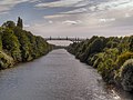
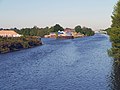
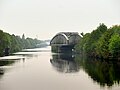
English: Stockton Heath is a civil parish and suburb of Warrington town, in Cheshire, England. It is located to the north of the Bridgewater Canal and to the south of the Manchester Ship Canal, which divides Stockton Heath from Latchford and north Warrington. It has a total resident population of 6,396.
Nederlands: Stockton Heath is een plaats in het bestuurlijke gebied Warrington, in het Engelse graafschap Cheshire. De plaats telt 6.396 inwoners.
village and civil parish in Warrington, Cheshire, United Kingdom  | |||||
| Upload media | |||||
| Instance of | |||||
|---|---|---|---|---|---|
| Location | Warrington, Cheshire, North West England, England | ||||
 | |||||
Subcategories
This category has the following 3 subcategories, out of 3 total.
B
M
T
Media in category "Stockton Heath"
The following 152 files are in this category, out of 152 total.
-

-
 A56 Chester Road heading east - geograph.org.uk - 4811176.jpg 640 × 480; 66 KB
-
-

-
 Bethesda Evangelical Church - geograph.org.uk - 3363892.jpg 910 × 562; 146 KB
-
 Brackley Street, Stockton Heath - geograph.org.uk - 401810.jpg 640 × 480; 78 KB
-
 Bridgewater Canal at Warrington - geograph.org.uk - 4466313.jpg 4,320 × 3,240; 3 MB
-
 Bridgewater Canal, London Road Bridge No 15 - geograph.org.uk - 4415950.jpg 4,320 × 3,240; 5.6 MB
-
 Bridgewater Canal, Lumb Brook Aqueduct 1944.JPG 3,261 × 2,392; 1.28 MB
-
 Bridgewater Canal, Lumb Brook Aqueduct 1945.JPG 3,840 × 1,080; 2.12 MB
-
 Bridgewater Canal, Red Lane Bridge 14 - geograph.org.uk - 4415947.jpg 4,320 × 3,240; 6.24 MB
-
 Bridgewater Canal, Stockton Heath - geograph.org.uk - 2057588.jpg 856 × 1,280; 178 KB
-
 Building new houses on a canal peninsula - geograph.org.uk - 3425749.jpg 1,024 × 768; 137 KB
-
 Car Park, Stockton Heath - geograph.org.uk - 4877682.jpg 2,784 × 1,568; 2.11 MB
-
 Chemical works in Latchford - geograph.org.uk - 3702444.jpg 3,872 × 2,592; 3.1 MB
-
 Chester Road (A56) - geograph.org.uk - 3363897.jpg 640 × 480; 65 KB
-
 Chester Road swing bridge is opening - geograph.org.uk - 2535614.jpg 640 × 426; 43 KB
-
 Clearwater Quays - geograph.org.uk - 3425024.jpg 1,024 × 768; 138 KB
-
 Crane on Bridgewater Canal - geograph.org.uk - 533707.jpg 640 × 477; 111 KB
-
 Crane ship passes open swing bridge, Warrington - geograph.org.uk - 5021501.jpg 5,370 × 3,580; 6.59 MB
-
 Cross Lane - geograph.org.uk - 3354308.jpg 640 × 480; 70 KB
-
 Derelict boat house, Bridgewater Canal, Stockton Heath - geograph.org.uk - 5634899.jpg 3,821 × 2,630; 1.06 MB
-
 Ellesmere Road, Stockton Heath - geograph.org.uk - 401800.jpg 640 × 480; 91 KB
-

-
 Fir Grove Hotel - geograph.org.uk - 2073291.jpg 640 × 426; 112 KB
-
 Fir Grove Hotel, Warrington - geograph.org.uk - 1916771.jpg 640 × 480; 63 KB
-
 Fox Covert 2066.JPG 3,264 × 2,448; 3.47 MB
-
 Fox Covert 2067.JPG 3,264 × 2,448; 3.24 MB
-
 Fox Covert 2070.JPG 3,264 × 2,448; 3.33 MB
-
 Fox Covert 2071.JPG 3,840 × 1,080; 2.06 MB
-
 Fox Covert 2073.JPG 3,264 × 2,448; 3.21 MB
-
 Fox Covert 2074.JPG 3,264 × 2,448; 3.62 MB
-
 Fox Covert 2076.JPG 3,264 × 2,448; 3.31 MB
-
 Fox Covert 2077.JPG 3,264 × 2,448; 3.23 MB
-
 Grappenhall Road (A56) - geograph.org.uk - 3363891.jpg 640 × 480; 78 KB
-
 Greenbank Road, Warrington - geograph.org.uk - 1887717.jpg 4,224 × 3,168; 2.21 MB
-
 Greenbank Road, Warrington - geograph.org.uk - 3354298.jpg 640 × 480; 68 KB
-
 House on Red Lane - geograph.org.uk - 2412688.jpg 2,592 × 1,944; 2.75 MB
-
 Houses off Greenall's Avenue - geograph.org.uk - 3425146.jpg 1,024 × 768; 172 KB
-
 Houses on Grappenhall Road - geograph.org.uk - 3363890.jpg 640 × 480; 71 KB
-
 Houses on Greenbank Road, Warrington - geograph.org.uk - 3354301.jpg 640 × 480; 47 KB
-
 Houses on Walton New Road - geograph.org.uk - 3363886.jpg 640 × 480; 69 KB
-
 Houses seen from the Bridgewater Canal 1959c.JPG 3,261 × 2,128; 1.61 MB
-
 Houses seen from the Bridgewater Canal 1960.JPG 3,264 × 2,448; 3.38 MB
-
 Houses seen from the Bridgewater Canal 1961.JPG 3,264 × 2,448; 3.36 MB
-
 Hunts Lane at Hill Top Road - geograph.org.uk - 2779397.jpg 640 × 480; 65 KB
-
 Hunts Lane from the bridge approach - geograph.org.uk - 2779393.jpg 640 × 480; 86 KB
-
-

-
 Knutsford Road Swing Bridge open - geograph.org.uk - 4786284.jpg 1,600 × 1,155; 294 KB
-
 Knutsford Road Swingbridge - geograph.org.uk - 3060775.jpg 640 × 481; 460 KB
-
 Knutsford Road swingbridge - geograph.org.uk - 3425031.jpg 1,024 × 768; 137 KB
-
 Knutsford Road swingbridge closing - geograph.org.uk - 3425107.jpg 1,024 × 768; 122 KB
-
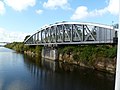
 Latchford High Level Bridge - geograph.org.uk - 2614247.jpg 1,024 × 759; 128 KB
-
 Latchford High Level Bridge - geograph.org.uk - 2778581.jpg 640 × 480; 52 KB
-
 Latchford High Level Bridge - geograph.org.uk - 3672349.jpg 640 × 466; 305 KB
-
 London Bridge (Stockton Heath-Appleton) - geograph.org.uk - 401845.jpg 640 × 480; 110 KB
-
 London Bridge Inn, Stockton Heath - geograph.org.uk - 1658579.jpg 640 × 480; 70 KB
-

-
 London Road Swing Bridge - geograph.org.uk - 4786255.jpg 1,600 × 1,064; 215 KB
-
 London Road, Stockton Heath (A49) - geograph.org.uk - 401861.jpg 480 × 640; 78 KB
-
 London Road, Stockton Heath - geograph.org.uk - 2778490.jpg 640 × 480; 76 KB
-
 London Road, Stockton Heath - geograph.org.uk - 4877684.jpg 2,784 × 1,568; 2.09 MB
-

-
 Loushers Lane recreation ground - geograph.org.uk - 3443239.jpg 4,592 × 3,056; 7 MB
-
 Lumb Brook Road - geograph.org.uk - 3363896.jpg 640 × 480; 69 KB
-
 Manchester Ship Canal - geograph.org.uk - 2072880.jpg 640 × 426; 53 KB
-
 Manchester Ship Canal - geograph.org.uk - 4072737.jpg 640 × 427; 65 KB
-
-
 Manchester Ship Canal beacon 240 - geograph.org.uk - 3425732.jpg 1,024 × 768; 144 KB
-
 Manchester Ship Canal beacon 242 - geograph.org.uk - 3425118.jpg 1,024 × 768; 192 KB
-
 Manchester Ship Canal Bridges - geograph.org.uk - 3667963.jpg 640 × 494; 282 KB
-
-

-
 Manchester Ship Canal, Lower Walton - geograph.org.uk - 2968065.jpg 640 × 481; 502 KB
-
-
 Martham Close - geograph.org.uk - 3354311.jpg 640 × 480; 51 KB
-
 Methodist Church on Knutsford Old Road - geograph.org.uk - 3354305.jpg 1,024 × 685; 178 KB
-
 Mitchell Street, Stockton Heath - geograph.org.uk - 4674374.jpg 1,024 × 768; 174 KB
-
 Morning traffic - geograph.org.uk - 2073143.jpg 640 × 426; 93 KB
-
 Morrisons, Wilderspool - geograph.org.uk - 3987306.jpg 640 × 480; 54 KB
-
 Mulberry Tree, Stockton Heath.jpg 640 × 480; 72 KB
-
 Mural at Thorn Marine - geograph.org.uk - 533701.jpg 640 × 477; 92 KB
-
 Northwich Road swing bridge, Warrington.jpg 1,024 × 682; 446 KB
-
 Opening gambit - geograph.org.uk - 109019.jpg 640 × 426; 182 KB
-
 Orchard Street, Stockton Heath - geograph.org.uk - 4674369.jpg 1,024 × 768; 168 KB
-
 Plaque on London Bridge - geograph.org.uk - 4466318.jpg 4,320 × 3,240; 2.87 MB
-
 Police Station, Victoria Square, Stockton Heath, Cheshire.jpg 2,756 × 1,979; 1.1 MB
-
 Red Lane Bridge over the Bridgewater Canal - geograph.org.uk - 2412716.jpg 2,592 × 1,944; 3.03 MB
-
 Red Lane Bridge, Bridgewater Canal - geograph.org.uk - 2057563.jpg 1,280 × 856; 272 KB
-
 Red Lane Bridge, Stockton Heath.jpg 640 × 431; 93 KB
-
 Roman Road, Stockton Heath - geograph.org.uk - 401826.jpg 640 × 480; 85 KB
-
 Ship passes open London Road Swing Bridge, Stockton Heath - geograph.org.uk - 5021494.jpg 5,472 × 3,648; 6.38 MB
-
 Sky and dome - geograph.org.uk - 906330.jpg 640 × 521; 73 KB
-
 St Thomas's Church, Stockton Heath - geograph.org.uk - 4262939.jpg 1,600 × 1,200; 598 KB
-
 Stafford Road and Wilderspool Causeway - geograph.org.uk - 2415142.jpg 2,592 × 1,944; 2.03 MB
-
 Steam engine, Greenall Whitley Brewery - geograph.org.uk - 682314.jpg 640 × 432; 108 KB
-
 Stockton Heath - geograph.org.uk - 401855.jpg 640 × 480; 102 KB
-
 Stockton Heath - Village Centre.jpg 640 × 476; 124 KB
-
 Stockton Heath Christian Fellowship - geograph.org.uk - 4626753.jpg 1,024 × 766; 145 KB
-
 Stockton Heath fire station - geograph.org.uk - 266795.jpg 640 × 427; 218 KB
-
 Stockton Heath former Post Office development - geograph.org.uk - 5188726.jpg 3,834 × 2,735; 1.5 MB
-
 Stockton Heath Methodist Church - geograph.org.uk - 3363888.jpg 800 × 600; 84 KB
-
 Stockton Heath Methodist Church - geograph.org.uk - 4626744.jpg 1,024 × 768; 147 KB
-
 Stockton Heath Police Station - geograph.org.uk - 4626710.jpg 1,024 × 768; 152 KB
-
 Stockton Heath Post Office - geograph.org.uk - 4626729.jpg 1,024 × 768; 150 KB
-
 Stockton Heath Primary School - geograph.org.uk - 401833.jpg 640 × 480; 99 KB
-
 Stockton Heath, aqueduct - geograph.org.uk - 4626649.jpg 1,024 × 768; 240 KB
-
 Stockton Heath, Bethesda Evangelical Church - geograph.org.uk - 4626664.jpg 1,024 × 768; 167 KB
-
 Stockton Heath, Bridgewater Canal - geograph.org.uk - 4626679.jpg 1,024 × 768; 186 KB
-
 Stockton Heath, Grappenhall Road - geograph.org.uk - 4626696.jpg 1,024 × 768; 201 KB
-
 Stockton Heath, narrowboat - geograph.org.uk - 4626620.jpg 1,024 × 768; 184 KB
-
 Stockton Heath, Northwich Road Swing Bridge - geograph.org.uk - 4626723.jpg 1,024 × 765; 137 KB
-
 Stocktonheath.jpg 2,811 × 1,440; 3.26 MB
-
 The Bridgewater Canal - geograph.org.uk - 3363889.jpg 640 × 480; 72 KB
-
 The Causeway - geograph.org.uk - 3702415.jpg 3,872 × 2,592; 3.72 MB
-
 The Causeway Pub - geograph.org.uk - 2784114.jpg 800 × 600; 393 KB
-
 The Fir Grove Hotel - geograph.org.uk - 3443196.jpg 4,505 × 2,077; 5.86 MB
-
 The former Greenall Whitley brewery at Wilderspool - geograph.org.uk - 3702502.jpg 3,872 × 2,592; 4.07 MB
-
 The Heath - geograph.org.uk - 3702431.jpg 3,872 × 2,592; 4.56 MB
-
 The London Bridge pub - geograph.org.uk - 2778481.jpg 640 × 480; 53 KB
-
 The Manchester Ship Canal - geograph.org.uk - 2412757.jpg 2,592 × 1,944; 2.48 MB
-
 The Original Barber Shop, Stockton Heath - geograph.org.uk - 5021509.jpg 4,154 × 2,769; 2.93 MB
-
 The Red Lion, Stockton Heath - geograph.org.uk - 4674356.jpg 1,024 × 768; 154 KB
-
 Thorn Marine Chandlery - geograph.org.uk - 1658590.jpg 480 × 640; 81 KB
-
 Victoria Square, Stockton Heath - geograph.org.uk - 4674367.jpg 1,024 × 768; 153 KB
-
 Walton New Road at Belvoir Road - geograph.org.uk - 2778509.jpg 640 × 480; 78 KB
-
 Walton Road (A56) - geograph.org.uk - 3363887.jpg 640 × 480; 60 KB
-
 Walton Road - geograph.org.uk - 2778505.jpg 640 × 480; 62 KB
-
 Walton Road 2080c.JPG 2,397 × 2,502; 1.59 MB
-
 Walton Road 2081c.JPG 1,715 × 2,285; 979 KB
-
 Walton Road 2082c.JPG 2,364 × 2,902; 1.7 MB
-
 Walton Road 2083.JPG 3,233 × 2,425; 1.47 MB
-
 Walton Road 2084c.JPG 2,180 × 2,512; 1,021 KB
-
 Walton Road 2085c.JPG 2,717 × 2,163; 1.45 MB
-
 Walton Road 2086c.JPG 2,355 × 2,006; 1.03 MB
-
 Walton Road west of Chapel Lane - geograph.org.uk - 2778504.jpg 640 × 480; 65 KB
-
 Warrington Brick & Tile 2168c.JPG 2,364 × 1,859; 722 KB
-
 Warrington, swing bridge - geograph.org.uk - 2614171.jpg 1,024 × 768; 165 KB
-
 Warrington, swing bridge - geograph.org.uk - 2614337.jpg 1,024 × 767; 127 KB
-
 Wilderspool Business Park - geograph.org.uk - 1887741.jpg 4,224 × 3,168; 2.25 MB
-
 Wilderspool Causeway and London Road Bridge - geograph.org.uk - 2415007.jpg 2,592 × 1,944; 2.11 MB
-

-
 Winter -frozen canal - geograph.org.uk - 3323456.jpg 1,600 × 1,200; 422 KB
-
 Winter -frozen canal - geograph.org.uk - 3323464.jpg 1,600 × 1,200; 416 KB
-
 High Warren - geograph.org.uk - 373776.jpg 638 × 446; 42 KB
-
 River Mersey - geograph.org.uk - 323958.jpg 640 × 483; 98 KB
-
 Runcorn and Latchford Canal - geograph.org.uk - 323968.jpg 640 × 483; 132 KB
-

-
 Sunday Football - geograph.org.uk - 323976.jpg 640 × 483; 69 KB
-

-
 Thorn Marine Chandlery - geograph.org.uk - 401892.jpg 640 × 480; 116 KB


_-_geograph.org.uk_-_3363897.jpg)


_-_geograph.org.uk_-_3363891.jpg)


_-_geograph.org.uk_-_401845.jpg)

_enters_Stockton_Heath_-_geograph.org.uk_-_2778485.jpg)

_-_geograph.org.uk_-_401861.jpg)


_-_geograph.org.uk_-_3363887.jpg)


